Location: Valley way/ Scar Trail/ Valley Way/ Osgood/ Valley Way/ Upper Bruin Trail/Air Line
Date: 6/15/2014
Start/Finish Time: 5:30PM 6/14 – 2:00PM 6/15
Total miles: 8.6+/-
Weather: Cloudy overcast with scattered rain showers. High winds and precipitation on summits.
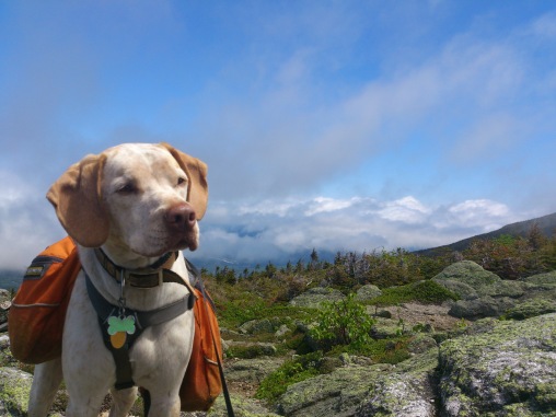
Comments: This week Abby and I had to do some things around the house before we got to go to the mountains. Once the chores around the house were done we grabbed Patton and headed North with the intentions of finding a place off trail to camp for the night on our way to the summit of Madison with hopes of bagging Adams as well. I had never been to Appalachia so I was open to what ever was possible. We Found an excellent spot and made our camp for the night. It was very wet and I was not even able to make a fire for us that evening. We made ourselves dinner and got to sleep soundly with the sounds of a waterfall to lull us to sleep.
Read more about the campsite below.
The next morning we awoke and made breakfast as groups of hikers passed our site including a large group of folks set out for a Presi- traverse. I wounder how they did with the weather conditions? Once we had breakfast and cleaned up we started hiking ourselves a little before 8 hoping the sun would beat the clouds. After an hour or so we realized that the sun was not winning this battle and it was downright cold. Close to the top I met a trough hiker on the Appalachian Trail who had started his adventure in February, his name was thunderfoot and he was off trail. I showed him the way back to the Osgood trail and made my way with my party to the top. We all wish Thunderfood good luck and strong steps on the rest of his AT bid! Abby, Patton, and I worked our way to the top and we summit ed about 10AM. The winds were strong and I nearly had to put on my spare set of socks as gloves. It got cold fast! It was time to get off the top.
We met some great folks on the way down and we made our way to the Madison hut. At this time Abby and I were feeling the struggle we had just had for the Madison summit and we did not want to test Adams on such a day so we made our way down taking our time on the many trails that I had not seen yet. Though there were no views on the summit we were able to get some on the way down, and it was still a great day in the mountains.
Camping: Aside from our excellent spot off of Watson path and Bruin rock there were many great spots lower on the mountain off of Valley way by Snyder Brook. If you are looking for something closer to the summit I would recommend some of the spots I found on the Air Line closer to the top. See the pictures below of the Air line Spots I found. If you like the spot we had right next to the waterfalls just take the Watson path and look for the Bruin rock sign. Right around the corner is a top notch site to spend the night. You won’t regret it. I am fairly sure this is a legal spot, but always check ahead of time to make sure your camping is in good standing with the local laws based on your area. For more on this check out Back Country Camping Rules.
Trail Cautions: Though there were a few downed trees they were mostly off the scar trail and that was only a slight detour for us. If you are making your way to the top without interruption you will be just fine.
Dog Notes: Patton had a great day hiking though the rocks at the summit of the make for slow going. Give yourself and your dog a little extra time to traverse this terrain.
Difficulty: 8/10 With harsh winds and unseasonable cold it was definitely a curve ball to our June plans. Expect anything in the Whites.
View Rating: 3/10 Got a couple good shots but as is the case sometimes our timing was off. Better luck this weekend. Here are the rest of the Pictures.


